Posts Tagged ‘power stations’

Nobody believed that yesterday it’s going to be a hot day – the temperature reached 33,3 degrees. And I knew I need to get a tan for the rest part of my body, because during the unconference Cycling for Libraries I managed to tan only partly and in six days I’m going to wear a beautiful dress for my friends’ wedding. So I went for a risk and went out for a cycling.

I left home shortly before half past one and returned back shortly before six. The cycling time was three hours and thirteen minutes, and I managed a distance of 50 km. The average speed was 15,5 km per hour, but the maximums speed was 34,6 km per hour.

I didn’t know where to cycle, I just knew I needed to find a cycle route without lot of shadows. And since I didn’t want to cycle on busy roads, I cycled downstreams along the River Derwent. I passed by Alvaston Park and the turn to Elvaston Castle, till I reached the bridge to Borrowash. Here I thought I will cycle to Long Eaton once more. But suddenly I noticed a road sign to Sandiacre, and remembered there is a really nice canal path I could cycle along. So I took the Nottingham Road (B5010) to Sandiacre.

Erewash Canal and Trent & Mersey Canal

Sandiacre is situated 11 km west of Nottingham and 14,5 km east of Derby. I have visited it once during one of my cycling days. So I was sure, I will like it.

Sandiacre

Indeed, it was a really good day for cycling – it was sunny and a light wind accompanied me. Before continuing along Erewash Canal, I had an ice-cream break. 🙂 And I noticed a rowan-tree full with orange berries. Is it autumn already? 😀

Rowan-tree

I cycled from Sandiacre Lock towards Trent Lock where Erewash Canal meets Trent & Mersey Canal. I cycled along the National Cycle Network No. 67, by the way. And here it was the Ratcliffe-on-Soar power station. Finally I managed to get to it really close!

Ratcliffe-on-Soar power station

I continued to cycle along Trent & Mersey Canal. But soon the canal path ended. So I need to find a solution. I knew that the canal path continues. So I decided to follow a couple of cyclists who apparently knew where they’re cycling and I felt they also like to cycle along the cycle path. Eventually, after taking some busy roads and loosing my cyclists, I managed to get back to Trent & Mersey Canal. I knew this part of canal path from my previous journeys, so I cycled towards Swarkestone Lock. I felt really hungry and both water bottles were empty, so after reaching Swarkestone Lock I cycled back to Derby along National Cycle Network No. 6.

It was a nice adventure and also a possibility to discover new cycling sites. Now I hope my skin won’t hurt too much after this active sunbathing on my bicycle.

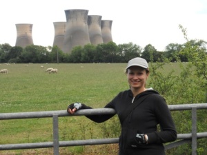
Yesterday I was amazingly happy! First, I cycled along the Trent & Mersey Canal, and, secondly, I finally reached a power station. Well, it was not the Ratcliffe-on-Soar power station, but the Willington Power Station (coordinates: 52° 51′ 21.6″ N 1° 32′ 26.6″ W).

Willington Power Station: the remaining huge cooling towers known as the Five Brothers

The coal-fired power stations were built on a site off Twyford Road, between Willington and Findern (villages in south Derbyshire). The Power Station was, in fact, two almost entirely independent generating stations situated on the same site. With separate management and staff, the few facilities they shared amounted to the coal and water supply. The two stations were designated Willington “A” and Willington “B”. The Trent valley, with its obvious water supply and proximity to the Nottinghamshire and Derbyshire coal fields, was an ideal choice. An extensive, although already clogged, railway system was also on hand to move the coal from pit head to power station.

It was built in the 1950s and closed in the 1990s (Willington “A” was closed in 1995, but Willington “B” – in 1999). Nowadays five imposing cooling towers, known as the Five Brothers, continue to dominate the skyline of the local area. They are 300 feet high and have a 218 feet diameter at the base.

I don’t know why, but the industry like railway system, old power stations or airfields fill me with enthusiasm. I remember a strategy game “Shortline Railroad”. I could play it all day long.

Shortline Railroad

Shortline is a real-time railroad management game that is easy to learn, fun to play, and quite addictive. The point of the game is to build rail lines, complete with signals and switches, and run trains over these lines. The problem is, you only control the signals and switches, not the trains themselves, and you must keep these trains from bumping into each other.

Enough of memories, will tell you about my ride! 😉

I started my ride from Normanton Road. How I hate cycling there! It is the most busiest and dangerous road for cycling ever. Well, it was the only way to reach the St. Chad’s Street. My aim was to reach Findern. So I cycled along St. Chad’s Street, Carlton Road, Valley Road, Brooklands Drive, Willson Road and Moorway Lane. And finally I took a straight cycle path towards Findern. I assume I passed by a house where Latvians could be living. That is so nice to pick up a name of “Rīga” for their house.

"Rīga 28"

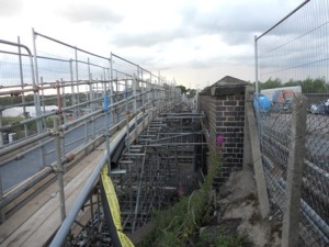
I also crossed a bridge which was not a bridge really, but a construction of pipes.

Construction of pipes

And also I managed to catch a feeling of Midsummer. I saw white dropworts, violet bird’s tares and jasmines.

Dropworts

This time I had a chance to cycle along a different part of Trent & Mersey Canal: from Stenson Lock (it is claimed to be the deepest on the canal) to Swarkestone Lock. I returned to Derby the same way I got to Swarkestone during the ride to Aston and Weston. That means I cycled along the National Cycle Network No. 6 until I reached the River Derwent.

I cycled for one hour and forty-eight minutes and managed a distance of 26,4 km (average speed: 14,5 km per hour, maximum speed: 32,2 km per hour).

On Saturday I cycled for three hours and a half and managed a distance of 41 km. And during my ride I visited another county of England – Leicestershire (by the way I’m living in Derbyshire). And this is a story of how I crossed the border of Leicestershire.

First part of my journey was the same as for the Ride to Elvaston Castle. I started my journey from Riverside Gardens in the city centre of Derby and followed the cycle path downstreams along the River Derwent towards Elvaston Castle. But this time I passed Elvaston Castle and continued along the River Derwent until I reached a bridge towards Borrowash (a village in Derbyshire) and turned left. I cycled along Station Road and turned right onto Nottigham Road. Then I took right turn onto Draycott Road and continued along until I reached Draycott (a village in Derbyshire). Next village I passed through was Breaston (a village in Derbyshire). Here I took right turn onto Sawley Road, crossed the railway and continued along Draycott Road (again!). I turned left onto Tamworth Road and continued along until I reached Long Eaton railway station (originally Sawley Junction).

At this very moment I need to confess to you: during my ride I tried to reach the Ratcliffe-on-Soar power station (a coal-fired power station), and it always seemed very close and easy to reach. So I didn’t even notice where my time went. It was an obsession. And a really silly obsession because I didn’t have a map of the other side of the River Derwent. I just followed the road signs that led me to Long Eaton (a town in Derbyshire) and then towards Castle Donington (a village in Leicestershire).

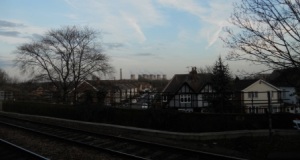
Long Eaton: View to Ratcliffe-on-Soar power station

I was 2,8 km away from the Ratcliffe-on-Soar power station (back then I didn’t even realize how hard it is to reach it by bike!), so I decided to cycle in the direction of power station. I cycled back to the point where I turned left onto Tamworth Road and continued along towards Castle Donington. From this point my journey was really uneventful. I crossed the border of Leicestershire and eventually I reached the highway A50. Guess what – bicycles are not allowed on the highways! So my dream of reaching the Ratcliffe-on-Soar power station was doomed.

At least I can show you one photograph of the Ratcliffe-on-Soar power station which I have taken once at East Midlands Parkway railway station (a railway station in Nottighamshire). Isn’t it amazing and impressive?

East Midlands Parkway: Ratcliffe-on-Soar power station

On my way back towards Derby, a full moon accompanied me. And I felt someone’s watching over me..